
A Forecasting tool set that allows forecasters to visualize and interact with meteorological data and helps make forecasts of various kinds a reality. It covers a broad range of data types and functionality to help in your day-to-day activities.
Data Standards
We support the following input formats
• WMO manual 306 compliant messages in TAC or TDCF format
• GRIB and GRIB2 from NWP (WAFC, ECMWF, Mesoscale, etc.)
• RADAR data in European OPERA format
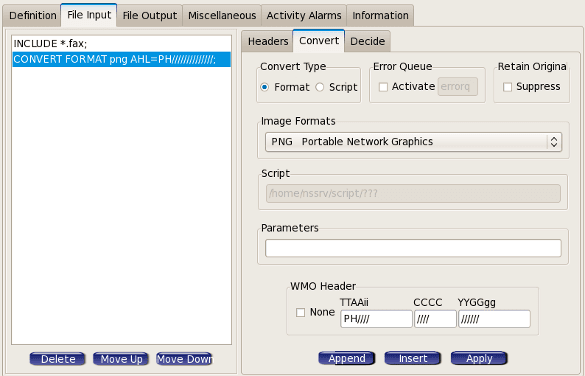
• PNG, BMP, JPEG and other raster image types
• EUMETCast satellite input
• Legacy T4 Fax
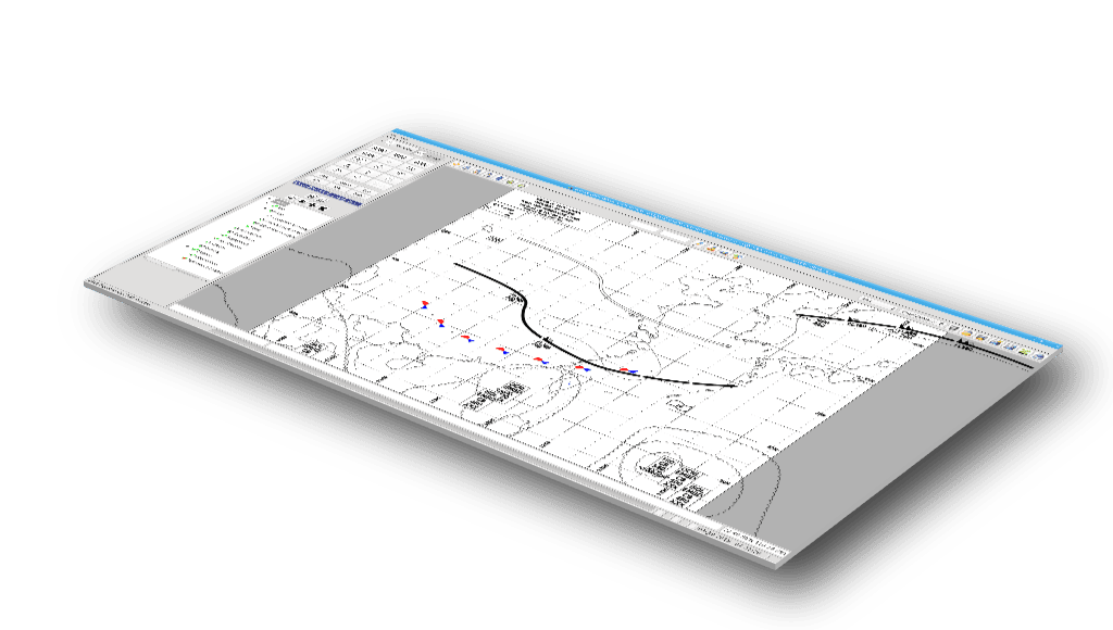
Use decoded TAC and TDCF for plotting station models, monitoring values against thresholds, creating Meteograms or store them in a CLIMAT database,
Automatically Create Products
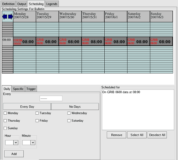
Scheduled products to be created at specific times or by specific events like at the completion of a GRIB reception run. Other examples are when sampling values from observations below a certain threshold or the arrival of a specific data type in a geographical region such as a SPECI arriving for any station inside a specific FIR.
Our client-server architecture allows multiple workstations to connect to the server-side data store. The servers can be paired in a High Availability to provide the forecasters with uninterrupted data services or the server and client can be hosted on a single workstation.
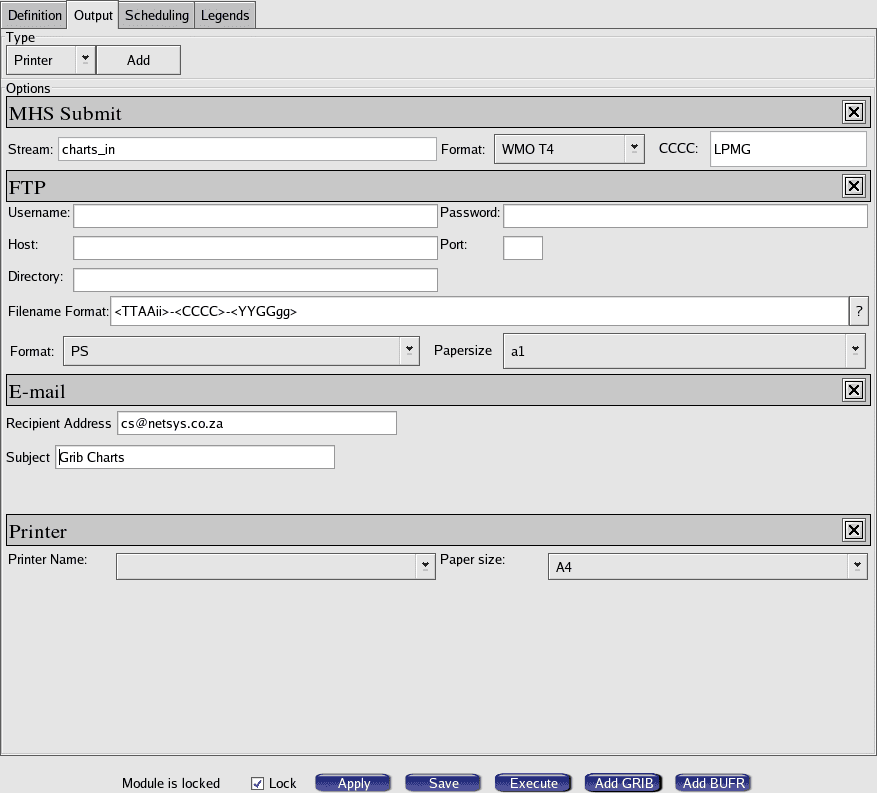
Variety of Products
Create a large variety of direct or derived products in PostScript, Adobe PDF or a number of raster formats including PNG, BMP and JPEG.
The products are:
• BUFR Significant Weather
• RADAR colourization
• Satellite colourization
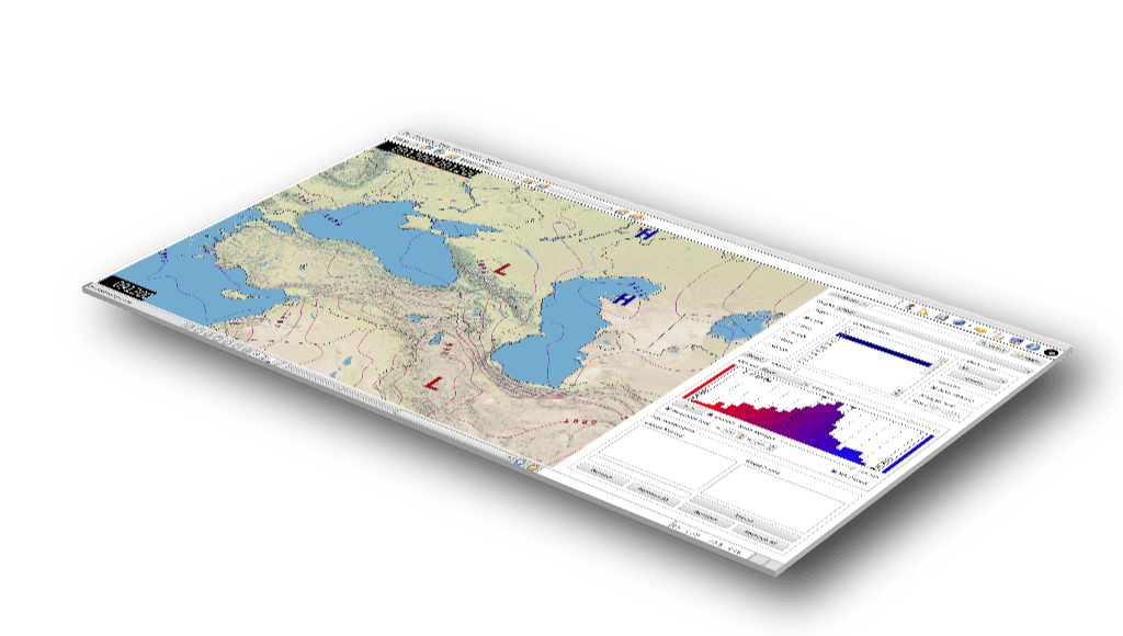
• SYNOP Station plots
• SYNOP Contour plots
• Upper Air plots
• Tephigrams
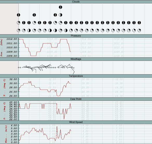
• Meteograms
• GRIB Shaded Topography
• GRIB ISO Contours
• GRIB U/V component arrows
User Interface
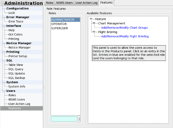
Access your workstation from anywhere in the world. Take control of user permissions. Get help from context sensitive tooltips. The package also comes with a complete set of manuals and NetSys provides training to ensure you can take full advantage of the system.
Populate the system with data from a WMO compliant message switch like the one used by nsMHS or by making use of drivers from our nsMHS and nsWAFS offerings. Enable EUMETCast Satellite reception by using components from our nsSAT offering.
Specialized Products
Create custom Meteogram pages easily by using the most powerful Meteogram Composition Tool in the industry. Fine tune SYNOP and Upper Air models. Create derived products using GRIB. Apply it to mesoscale model outputs. Product definitions are saved with relative time definitions so you can reuse them without having to perform the setup all over again.
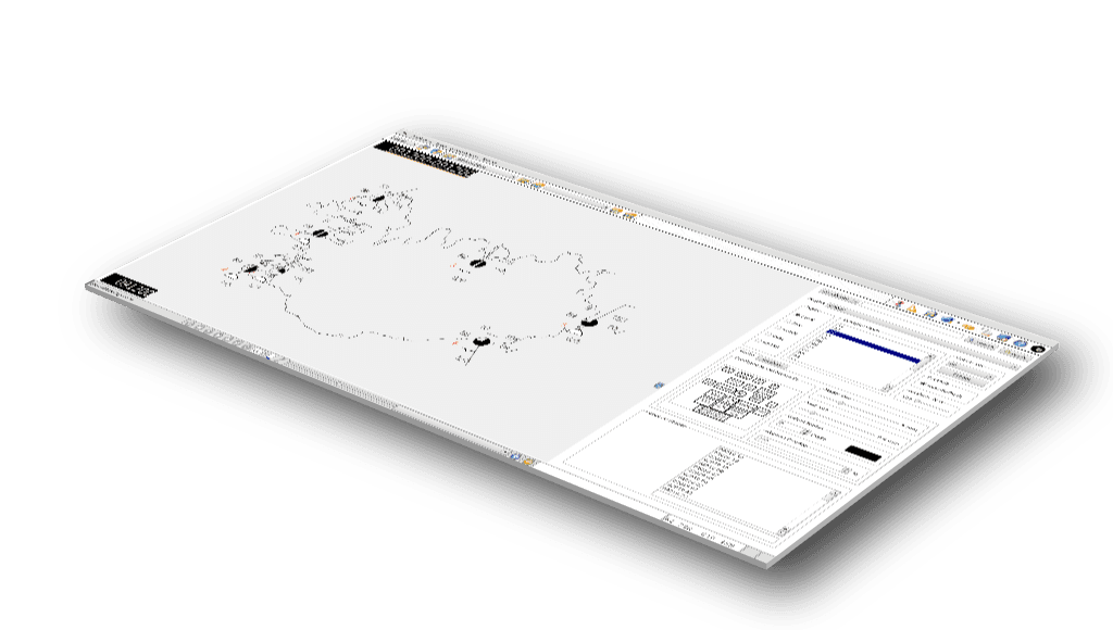
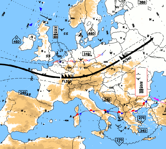
Chart Composition and Overlays
Use our powerful forecasting editor to compose regional aviation charts. Create overlays and enhance them using our complete palette of standard and custom weather symbols.


For the server and workstation platforms, NetSys elects to use Commercially Off The Shelf (COTS) hardware only, with a preference for Dell and HP equipment with hot swappable components for servers. The workstations make use of high-resolution LCD monitors and 3D accelerated graphics cards to make the forecaster’s experience smooth and of high fidelity. There is also the option to connect more than one monitor to each workstation for an extended working surface.


Compliant Industry Standards


Compatible Browsers